Anantics

Connecting

Internet of Things

RFID - BLE - LoRaWAN - UWB - GPS - Sensors

Practicing

Agile DevSecOps

Enterprise Architecture - CI / CD

Building

Location Intelligence

Spatial Data - GIS Applications

Scaling

Digital Transformation

Analytics - Big Data - Cybersecurity

Company Overview

Anantics is a leading technology solutions provider, with expertise in DevSecOps, GIS, and IoT solutions custom design, development, and implementation.

Our Real-Time Location Systems (RTLS) include options of RFID, BLE, UWB, LoRaWAN, and GPS sensors. Solutions also include Queue Management System, Panic Alert System, Temperature Monitoring System, geoCallout® and GeoMobix®.


14

+

Years

35

+

OEM Partners

120

+

Solutions

We develop digital identification solutions that allow physical products to be recreated in a digital twin.


Expert IoT Sensor Systems Integrator


Solutions & Services

Software Engineering

Agile in continuous improvement and continuous development (CI/CD) for DevSecOps. Multiple technology stacks utilization for web apps, mobile apps, databases, SDKs, web APIs, microservices, containers, message queuing, ETL, cloud computing, cybersecurity, and analytics.

Geospatial Expertise

Extensive geospatial expertise in the design and development of geographic information systems (GIS), field data collection, orthorectification, geospatial data transformation and conflation, producing intuitive spatial analytics for the discovery of trends and relationships.

RFID Tracking

Implementations of personnel and asset Tracking solutions by utilizing Passive UHF RFID Readers, Antennas, Tags, and Software which identifies, locates, and tracks objects. Hybrid integrations with HF RFID, Fingerprint Readers, Buzzers, Tower Lights, and Security Gates, etc.

BLE Tracking

Real-Time Location Systems (RTLS) for asset tracking and indoor positioning by utilizing Active BLE Beacons and BLE Tags with built-in accelerometer and other sensors. Software integrates multiple components in the BLE driven application for many industries.

UWB Tracking

Utilization of UWB for high precision indoor positioning systems, due to UWB’s ability to detect via ToF (Time of Flight), TWR (Two Way Ranging), TDoA (Time Difference of Arrival), AoA (Angle of Arrival) techniques, and less interference from other RF transmissions.

LoRaWAN Tracking

Emerging LoRa (Long Range) LPWAN integration and implementation to monitor various IoT device health and data, without a need for traditional Internet connectivity. Hybrid utilization of BLE and LoRaWAN technologies deliver low-cost solution over long distances.

GPS Tracking

Real-Time GPS tracking and monitoring solutions for powered vehicles and non-powered assets. Our solutions bring the option to utilize rugged ATEX/IECEx-certified GPS devices in Zone 0 hazardous environments. We offer a range of GPS trackers for outdoor applications.

Queue Management

Electronic or physical Queue Management Systems (QMS) to manage walk-in services, and customer flows. Multiple options of physical, digital and hybrid QMS solutions, with mobile/web apps, modern displays, ticket dispensers, kiosks, and remotes in integrated solutions.

Panic Alert System

Implementations of multiple custom Panic Alert Systems (PAS) using nRF and zigbee technologies, which is not dependent on traditional ethernet connections. Also known as Emergency Calling Systems to display raised alerts on large TVs for situational awareness.

Temperature Monitoring

Physical Labels and Digital solutions that combine both thermal management and monitoring for universal visibility and unlimited control of temperature. Physical labels change colors for ascending or descending temperatures. Digital loggers record all defined events for temperature.

geoCallout®

geoCallout® is an Add-In Utility for Esri ArcGIS Desktop. geoCallout® produces smart callouts (chem-boxes) with tabular data with custom leader-lines attached to respective map features. Its outputs are highly customizable and work with points, polylines or polygons.

GeoMobix®

GeoMobix® is a secured cloud-based Software as a Service (SaaS) solution for spatial mobile field data collection along with digital form, photos, videos and audio clips. Management tool for many industries as it can be dynamically configured as per the industry's use-case.


What Clients Said About Us

James L.

I wanted to take a minute to thank you for the tremendous support you and your team at Anantics provided us over these last two years. Your technical skills, professionalism, and commitment to excellence have been much appreciated. I have been in the consulting business for close to 30 years supporting government healthcare clients. During this period, I have had the opportunity to work with numerous subcontractors and I must honestly say that you and your team are at the top of my list. I look forward to working with you again at the nearest opportunity.

Barry P.

Anantics has been working together with us for almost three years. During this time we have jointly consulted with the municipal client to create two separate geospatial systems.

Anantics supplied the technical resources to staff the projects beginning with system design and continuing through application development. Without getting into too much detail, the resources were to redesign and upgrade currently out of date applications and bring them up to current modern technologies.

Anantics management continues to deliver accurate and timely project status reporting and time accounting. Their technical resources are excellent. Both projects continue with all scheduled services delivered on time and within budget.

William H.

Our firm collaborated with Anantics for over 3 years. Anantics has provided Geographic Information Systems (GIS) application development support on a number of key projects, during this time. Anantics expertise has been invaluable in helping us fulfill our customer interests. These pursuits, like the development of a Natural Gas Pipeline Application, for a key client in Oklahoma, carried prominence, within our given portfolio. Anantics work on such initiatives has been exemplary and surpassed our clients expectations.

We look forward to joining forced with Anantics on future GIS engagements and would recommend their services to other organizations seeking a value added solutions partner.

Adam K.

We contacted Anantics about geoCallout. Within a couple hours we had demo’s setup and trial version to play around with. They showed us all the ends and outs of how to use geoCallout tool. We couldn’t believe how easy and user friendly it was from the start. Obviously we had a learning curve with never using it before but Anantics was there to answer any question and help out with our new workflows. The previous work flow we were using it was taking about 75% longer compared to using geoCallout. Thank you Anantics for paving the new way of providing mass amounts of data. We will never go back to the old way doing things.

Samuel P.

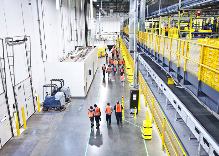
I wanted to take the time to let you know what a pleasure it has been working with you and your team at Anantics. As we all have said many time, our experience with your team over the past 5 years has been very good – not only were you able to assist in creating a solution in getting our new facility up and running with new tracking systems, but you all have been able to help troubleshoot when called upon.

It’s a pleasure to work with a firm which no only assists in implementing solutions, but also adds value in thoughts and ideas.

Pankaj G.

Anantics is an agile organization with delightful response time and offers full baked ready to use customized response to each and every requirement, no matter how difficult it seems to be. Anantics technical team personnel have delivered quality solutions and we look forward working with you on other potentials.


Client Base

Federal, State, Municipal

Water, Wastewater, Oil, Gas, Electric

Automotive, Manufacturing, Industrial

Aerospace, Airports, Insurance, Transportation

Environmental, Engineering, Construction

Healthcare, Education, Telecommunication

View More